Invaders – pests in the southwest

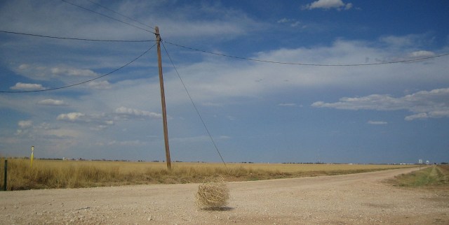
Tumbleweed by Jez Arnold

A tumbleweed (or Russian thistle) by Jez Arnold

I never imagined that tumbleweed, the iconic extra in any western movie, is actually an ‘obnoxious weed’, to quote from a sign at Cathedral Gorge State Park in Nevada.

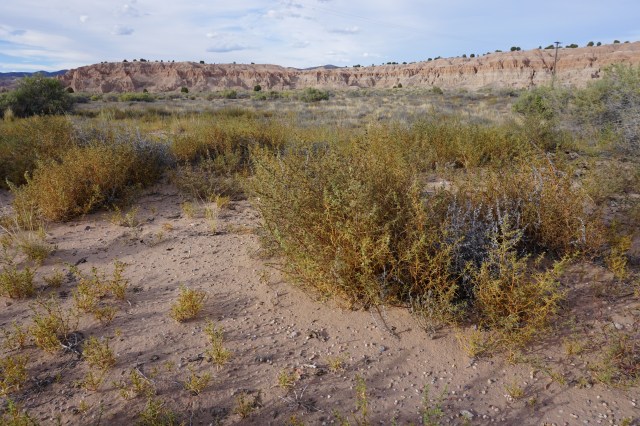
DSC00555

Russian thistle at Cathedral Gorge State Park, Nevada.

Tumbleweeds are the seed dispersing stage of ‘Russian thistle’ a plant that is bright green until after it has flowered. In autumn it dries out, breaks away from its roots and ‘tumbles’ through the landscape spreading more than 250,000 seeds per plant. It probably arrived from the Ural Mountains of Russia via flaxseed imported to South Dakota by Ukrainian farmers in the early 1870s and by the early 1900s had spread to most of the western states. Russian thistle thrives in disturbed soil, requires very little moisture and has proliferated amazingly well.

Kiwis know all about issues with introduced pests in New Zealand and the country spends millions of dollars a year trying to save our vulnerable species but I hadn’t expected to find similar problems in the USA.

DSC01070

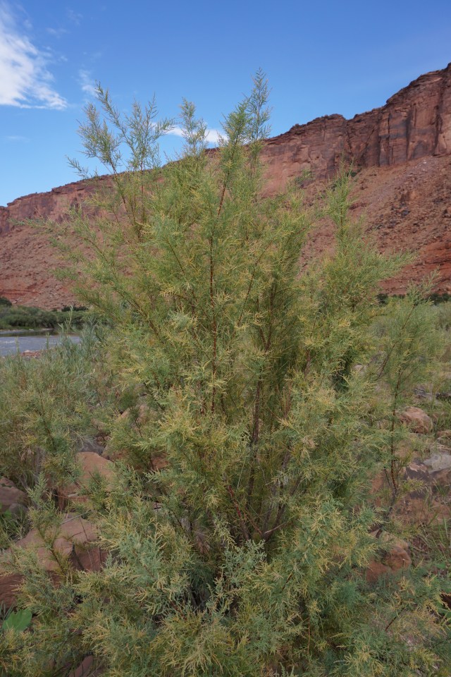
A small tamarisk tree beside the Colorado River near Moab, Utah.

And Russian thistle wasn’t the only unwelcome intruder that we saw. Almost as ubiquitous was Tamarisk (or salt cedar), a tree native to Asia which was introduced as an ornamental and for erosion control particularly along stream banks where it has been spectacularly successful. It can spread along riverbanks at an estimated speed of 20 kilometres per year! It also very effectively suppresses the growth of other plants by excreting salt which makes the ground beneath it unbearable for seedlings of other species. And if that wasn’t enough, it drinks a lot of water! Mature trees can have roots at least 30 metres below the soil surface and these suck up water which native plants and animals need.

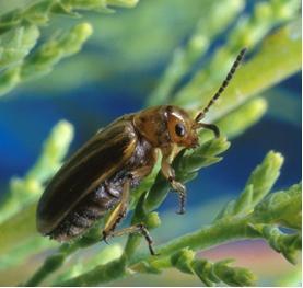
It is one of the world’s super-plants and is tough to get rid of. If it is cut down it can regrow shoots 40 centimetres long in two weeks and can be more than two metres tall in two years. If you burn it, it grows back. In order to try and control it the tamarisk beetle has been imported to the US. So far they have only eaten tamarisk and over several years can kill a tamarisk tree by continually eating its foliage and stopping the tree photosynthesizing.

saltcedar-leaf-beetle

Tamarisk or saltcedar beetle. They were introduced in 1999 and are now found on about 10 million acres of land in Utah and Colorado.

The beetles seem to be working in some areas but meddling with eco-systems is never straight forward. Stands of dead tamarisk are a fire hazard and have to be manually cleared and it takes a while for other plants (hopefully native but often not) to recolonize the areas. During this time other plants and animals suffer from the effects of things such as stream-side erosion and lack of shelter and nesting spots.

We spent quite a bit of time getting acquainted with the amazing Colorado River and couldn’t help but be impressed with this mighty river and fascinated (and somewhat horrified) by the many different ways that its water is being used.

We learned that the native fish of the Colorado River are ‘one of the most bizarre and unusual faunas found anywhere in the world’ and that many of them are endemic to that particular river system.  Dams and introduced fish (such as Asian carp, introduced as a food source) are having a huge effect on the 14 native fish species which include native carp, minnows and suckers and the astonishing Colorado pikeminnow which can grow up to 2 metres long – or used to.

NZ mudsnails

Of special interest (and slight embarrassment) to us was the problems being caused by New Zealand mudsnails. Yes, I know! Who would think that a native animal that most of us have never heard of would be causing problems overseas. They were first discovered in Idaho in 1987 and have spread widely, probably being dispersed by birds as well as fishermen. It was sobering to realise the extent of problems caused by both the deliberate and accidental introduction of non-native species in a robust country like the USA and that even something like the New Zealand mudsnail which is innocuous in an ecologicaly vulnerable country like New Zealand can be a pest overseas.

DSC00709

The Colorado River at Lees Ferry, not far below Glen Canyon Dam. New Zealand mudsnails were first found here in 2002.


Posted in Uncategorized | Tagged , , , , | Leave a comment

Trip Highlights – part 2

This posting shows some more of the highlights in Utah, Arizona, Nevada and the start of our California experience. Of course it is hard to choose the photos that best show how it is, as I can’t show the sounds, the smells and the general feeling of a place. These will have to suffice in the meantime.

image

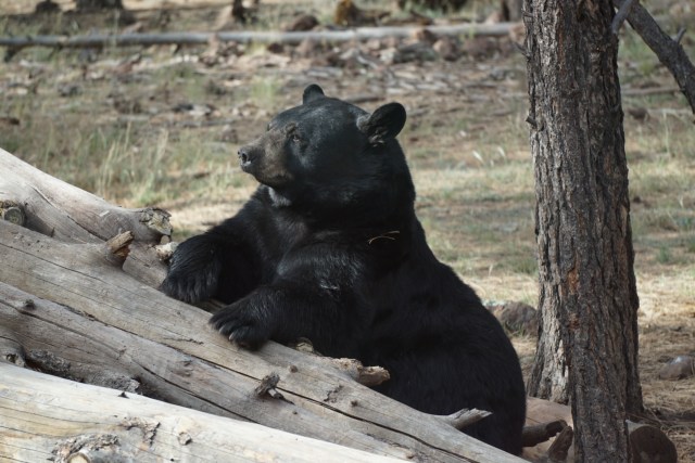
Finally we've seen a black bear - this one at Bearizona near Williams in Arizona. The bears in this enclosure were sick of being gawked at by people in cars and were ready to hibernate, unlike the cubs in another enclosure who seemed full of energy.

image

An antelope squirrel at Valley of Fire State Park, Nevada, spread-eagled next to our picnic table. Not sure if it was cooling itself on the shaded concrete or marking or what?!

image

Observation Point, Zion National Park. This was an amazing climb up from the valley floor through about four different landscapes; cliff, canyon, valley walls and finally mesa top - fantastic! We started at about 7.30am and were the fourth group to arrive but the way down was a very busy experience.

image

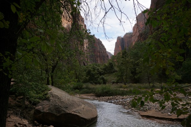
Just downstream from The Narrows, Zion National Park Utah.

image

Eddie on petrified sand dunes at Snow Canyon State Park, Utah. The canyon was named after a person, I can't imagine that it ever gets snow.

image

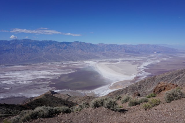
Looking down on Badwater Basin, Death Valley National Park, California. We couldn't drive through the basin as the road had been damaged by flooding - you can see water in the basin which is usually a dry salt flat.

image

Coyote in Panamint Valley, Death Valley National Park. We've been enchanted by our few glimpses of these wily animals and we've often heard them at night. They are amazing survivors and despite the fact that more than 100,000 of them a year are killed (shot, poisoned etc) they are holding their own.

image

Manzanar National Historic site, California, remembers the internment of more than 120,000 Japanese (both US citizens and those born in Japan) after the bombing of Pearl Harbour by the Japanese in 1942. Manzanar, in Eastern California, was one of 10 camps built to house families uprooted with short notice (most had only two weeks to sell their property and pack what they could carry). The interpretation centre and replica barracks are very good and the experience was moving, sobering and occasionally harrowing and was a reminder of the fragility of human rights in the face of hysteria.

image

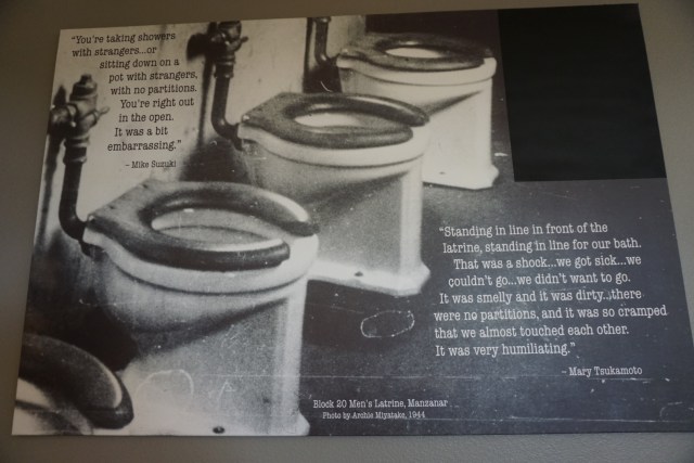
Interpretation panel in the toilets (or should I say restrooms) at Manzanar National Historic Site - brilliant!

image

And on a lighter note, Eddie and the 'stang at Red Rock Canyon State Park, California.

Posted in Uncategorized | Leave a comment

Trip highlights – part 1

It’s been a real challenge to find time to get the blogs that I want to write finished because there is so much to see and do. In the meantime I thought I would put together a selection of photos of trip highlights with brief captions. This is a wonderful country to explore!

image

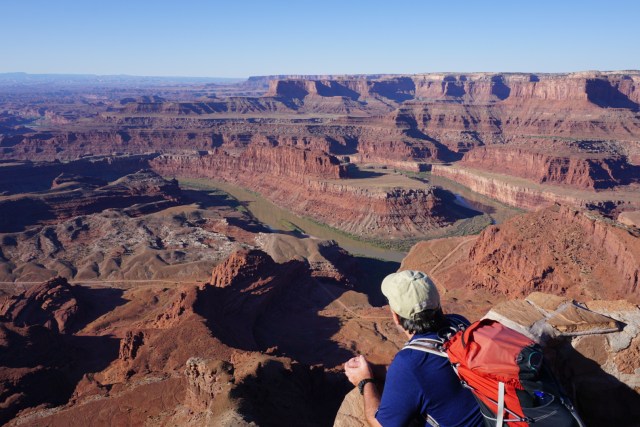
The Colorado River from Dead Horse Point State Park, Utah.

image

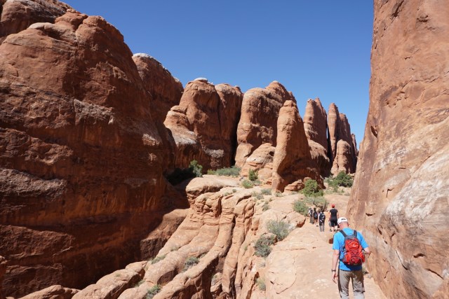
On a ranger-led hike through the restricted Fiery Furnace area at Arches National Park, Utah.

image

Eddie at Delicate Arch, Arches National Park. We went early in the morning to avoid the crowds so the light wasn't brilliant for photos but it was definitely worth seeing.

image

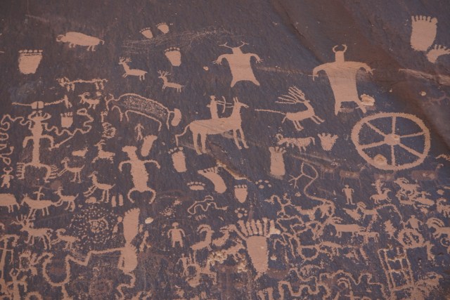
Petroglpys at Newspaper Rock, Canyonlands National Park, Utah.

image

Our favourite fire-ring so far - Devils Canyon Campground, Utah.

image

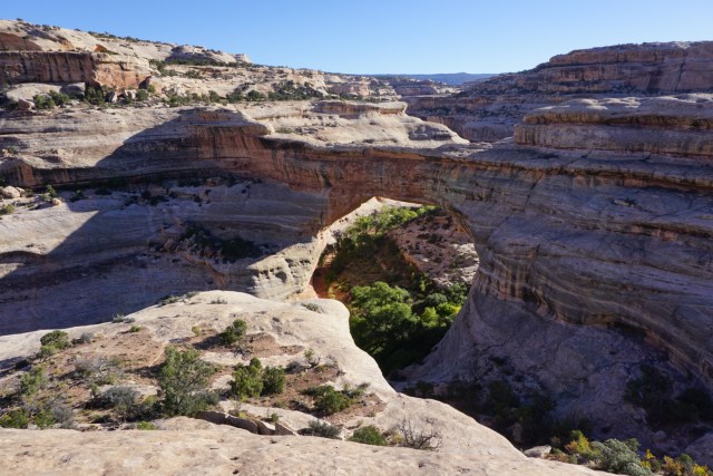
Sivapapu Bridge at Natural Bridges National Monument - from above.

image

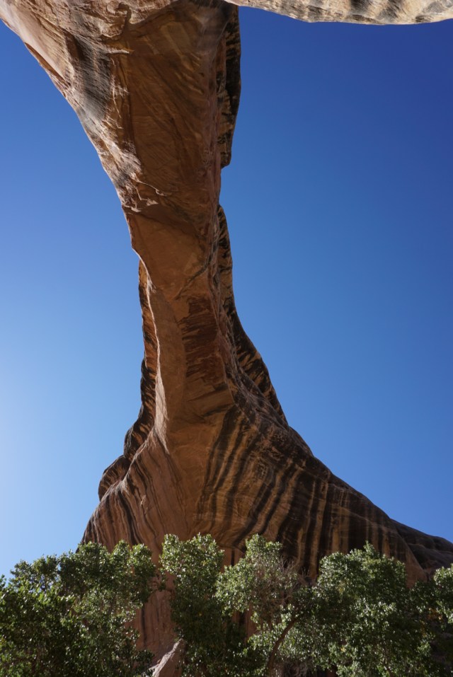
And from below. We had a great hike up a canyon travelling under another two bridges.

image

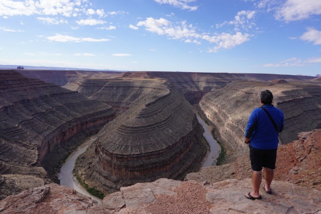
Eddie at Goosenecks State Park, San Juan River, Utah.

image

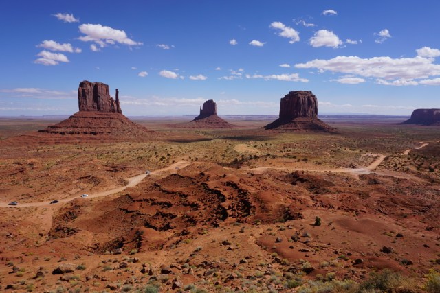
Monument Valley (of course!), Navajo Tribal Park.

image

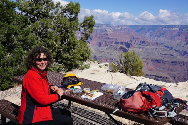
Best picnic spot so far, South Rim of Grand Canyon, Arizona.

It’s hard to show everything, but hopefully you can get an idea of what we are seeing – lots of very cool scenery.

Posted in Uncategorized | 2 Comments

The Great Depression & the great outdoors.

While travelling along the very scenic highway 12 in south-west Utah we stopped for lunch at the small town of Escalante. In the restaurant was an unattributed list of the 15 best drives in the world. US highway 12 between Panguitch and Torrey was ranked as the second best drive scenic drive in the world but guess what was ranked number one? The Milford road in New Zealand. After pausing for a moment to feel a pulse of pride I realised that both of these roads had been built by work schemes during the Great Depression and wondered how much tourism and public access in both countries owes to the Great Depression? In the US it appears that it is quite a lot.

image

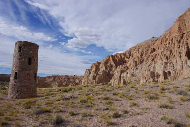
Water tower at Cathedral Gorge State Park, Nevada, built by the CCC.

During the Great Depression President Franklin Roosevelt established the Civilian Conservation Corps (CCC) as a public work relief programme. To sign-up men had to be between the ages of 17 & 28, be unmarried and from families receiving government relief. They fought forest fires, planted trees and built roads, trails and recreation facilities on public lands. For this they were paid $30 a month and had to send $25 of that home to their families. Part of what is now US highway 12, connecting the then remote towns of Escalante and Boulder, was built by the CCC between 1935 and 1940. The road travels through an amazing landscape of mostly solid rock and required enormous effort, ingenuity and ‘tons of dynamite.’ The men who worked on it nick-named it the ‘Million Dollar Road.’

image

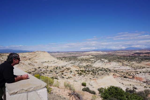
Eddie at a scenic overlook on highway 12 - the road snakes away into the distance

Esclante’s economy was initially based on farming but by 1910 the native grasses were ‘gone forever’ due to overgrazing. Interest then turned to mining and logging but these industries came to a close with the creation of the Grand Staircase-Escalante National Monument (the country’s largest outside of Alaska) in 1996. Locals were furious and public ‘hangings’ of Clinton were carried out but the town seems to have settled into providing services for visitors. We were a little startled to see a ranger fully armed and wearing a flak jacket at the Monument visitor centre so perhaps things are not quite as calm as they seem?

image

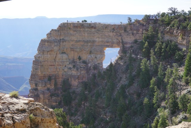
A viewpoint built by CCC along the North Rim of Grand Canyon - no doubt without today's safety measures

image

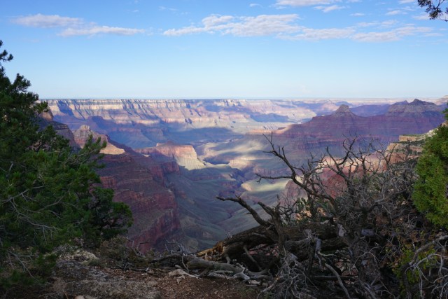
A view from the North Rim of Grand Canyon

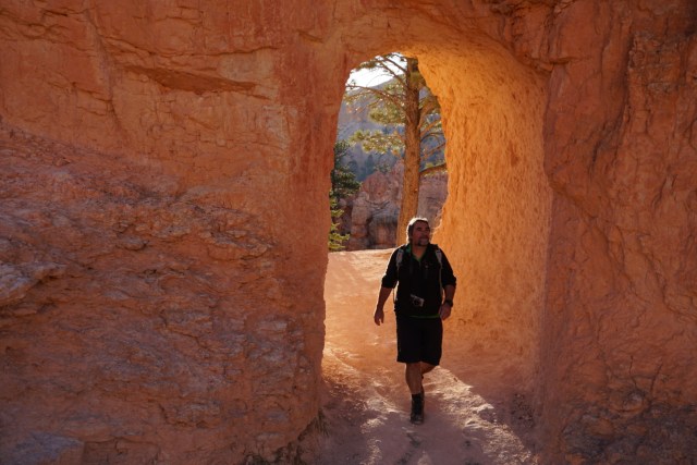
At many of the state parks, national monuments and national parks that we’ve gone to we’ve seen some amazing work done by these men under what must have been pretty tough working conditions. Although they probably wouldn’t be built today, given that we tend not to dynamite and concrete things in national parks, the tunnels and switchbacks at Bryce Canyon National Park, for example, give access to the wonderland of hoodoos and spires below the rim and really enhanced our experience of the park.

image

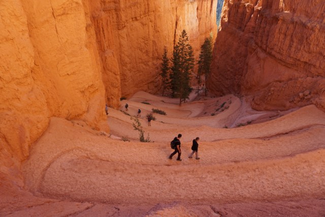
A tunnel on the Peekaboo Trail at Bryce Canyon

image

One of the two switchbacks that provide access down the near vertical descent below the rim.

At the wonderful Colorado National Monument, which really is a park that you drive around, the road which affords tourists such fantastic views was built by the CCC. The road climbs up from the plains below via switchbacks and tunnels and then hugs the edge of cliffs until it descends again at the other end of the park.

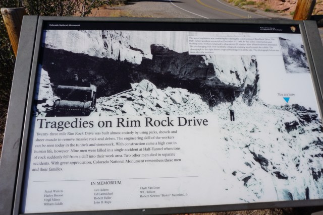
The work was not done without significant human cost though and this is acknowledged at Colorado National Monument with a panel (shown below) detailing the deaths of nine men in a single accident. Again, this has echoes of the Milford Road.

image

It is hard not to be impressed with what has been achieved and be glad, that although this work probably wouldn’t be undertaken today, that it was done. Mostly the work as been done sympathetically using local materials and has provided access to many scenic wonders. The ease of access has created its own problems though and I think it is a good thing that no more roads and structures are being built. There is still wilderness here for people who are willing to make the effort to get to it.

Posted in Uncategorized | Leave a comment

The Great Depression & the great outdoors.

While travelling along the very scenic highway 12 in south-west Utah we stopped for lunch at the small town of Escalante. In the restaurant was an unattributed list of the 15 best drives in the world. US highway 12 between Panguitch and Torrey was ranked as the second best drive scenic drive in the world but guess what was ranked number one? The Milford road in New Zealand. After pausing for a moment to feel a pulse of pride I realised that both of these roads had been built by work schemes during the Great Depression and wondered how much tourism and public access in both countries owes to the Great Depression? In the US it appears that it is quite a lot.

image

Water tower at Cathedral Gorge State Park, Nevada, built by the CCC.

During the Great Depression President Franklin Roosevelt established the Civilian Conservation Corps (CCC) as a public work relief programme. To sign-up men had to be between the ages of 17 & 28, be unmarried and from families receiving government relief. They fought forest fires, planted trees and built roads, trails and recreation facilities on public lands. For this they were paid $30 a month and had to send $25 of that home to their families. Part of what is now US highway 12, connecting the then remote towns of Escalante and Boulder, was built by the CCC between 1935 and 1940. The road travels through an amazing landscape of mostly solid rock and required enormous effort, ingenuity and ‘tons of dynamite.’ The men who worked on it nick-named it the ‘Million Dollar Road.’

image

Eddie at a scenic overlook on highway 12 - the road snakes away into the distance

Esclante’s economy was initially based on farming but by 1910 the native grasses were ‘gone forever’ due to overgrazing. Interest then turned to mining and logging but these industries came to a close with the creation of the Grand Staircase-Escalante National Monument (the country’s largest outside of Alaska) in 1996. Locals were furious and public ‘hangings’ of Clinton were carried out but the town seems to have settled into providing services for visitors. We were a little startled to see a ranger fully armed and wearing a flak jacket at the Monument visitor centre so perhaps things are not quite as calm as they seem?

image

A viewpoint built by CCC along the North Rim of Grand Canyon - no doubt without today's safety measures

image

A view from the North Rim of Grand Canyon

At many of the state parks, national monuments and national parks that we’ve gone to we’ve seen some amazing work done by these men under what must have been pretty tough working conditions. Although they probably wouldn’t be built today, given that we tend not to dynamite and concrete things in national parks, the tunnels and switchbacks at Bryce Canyon National Park, for example, give access to the wonderland of hoodoos and spires below the rim and really enhanced our experience of the park.

image

A tunnel on the Peekaboo Trail at Bryce Canyon

image

One of the two switchbacks that provide access down the near vertical descent below the rim.

At the wonderful Colorado National Monument, which really is a park that you drive around, the road which affords tourists such fantastic views was built by the CCC. The road climbs up from the plains below via switchbacks and tunnels and then hugs the edge of cliffs until it descends again at the other end of the park.

The work was not done without significant human cost though and this is acknowledged at Colorado National Monument with a panel (shown below) detailing the deaths of nine men in a single accident. Again, this has echoes of the Milford Road.

image

It is hard not to be impressed with what has been achieved and be glad, that although this work probably wouldn’t be undertaken today, that it was done. Mostly the work as been done sympathetically using local materials and has provided access to many scenic wonders. The ease of access has created its own problems though and I think it is a good thing that no more roads and structures are being built. There is still wilderness here for people who are willing to make the effort to get to it.

Posted in Uncategorized | 2 Comments

Colour Country – southwest Utah

image

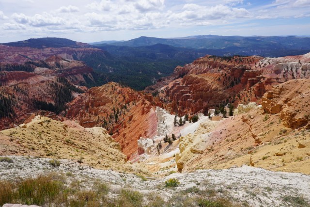
Cedar Breaks National Monument - a fantastic world of colour.

Since we arrived in southwest Utah we have been astounded by the colours of the landscape and the quality of the hiking. The colours are the result of the layers of mostly iron-rich rock and the many years of erosion that the layers of different hardnesses of rocks have endured. The fantastic hiking is the result of the lack of biting insects, consistently good weather, clear open trails and wonderful vistas.

image

It was less than 10 degrees C at Cedar Breaks - not quite what we've got used to.

The altitude at Cedar Breaks National Monument (the trees are cedars and the ‘breaks’ are the edges of the cliffs) is about 10,500 ft (3,200m) and the air here was brisk! There are some great viewpoints and a couple of short hikes but to get amongst the spires and hoodoos we had to wait until we got to Bryce Canyon National Park.

image

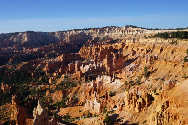
Bryce Canyon National Park - an amazing collection of colour & form.

Bryce Canyon is not actually a canyon at all but a row of eroded ampitheatres along about 30 kilometres of a plateau which is about 2,750 metres high at the highest end. Some of the rock layers are quite soft and erode rapidly. The hoodoos and spires are formed when a cap of harder rock protects the layers underneath from erosion.

image

Bryce Canyon, below the rim and amongst the hoodoos.

What is special about Bryce Canyon is the fact that you can get down below the rim and amongst the rocks on a series of fantastic trails built by the Civilian Conservation Corps in the 1930s (I will write more about the CCCs in a later blog). You can see one of the trails below in the photo Eddie took through a window in a fin of rock. All of the trails start with a descent, which is great fun, but end with a steep but well graded climb back up to the rim. It was busy at Bryce so we left for our walks very early and it was always a shock to meet the hordes of people just below the rim (some of whom were struggling to get back up) and the bus-loads of tourists at the rim viewpoints.

image

Eddie's clever photo on the Peekaboo Trail, Bryce Canyon.

Our next major park was Capitol Reef National Park, the least visited of Utah’s five national parks. The park consists of a 160 kilometre long mono-cline thrust up by movement in the earth’s crust. It is called a reef because it was an impenetrable barrier to early travellers and capitol because one of the whitish domes of Navajo sandstone looks like the US Capitol building in Washington.

image

Rock colours at Capitol Reef, Navajo sandstone is on the top of the ridge while in the background is a cliff of red wingate sandstone.

Capitol Reef is definitely a park for hikers. There is a scenic drive but this hardly gives you an idea of the beauty of the park. We did two wonderful walks and hope to come back one day with a 4WD so that we can access more. Our first was an 18 kilometre hike from the campground to Cassidy Arch which traversed up and down rock platforms, gullies and a canyon.

image

Looking down on the scenic drive from the 'Frying Pan' trail to Cassidy Arch.

image

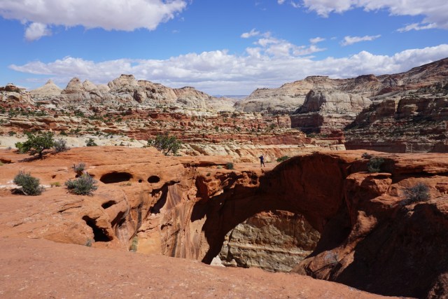
Eddie on Cassidy Arch, supposedly visited by Butch Cassidy.

We finished our exploration of Capitol Reef with a hike through Grand Wash and then a quick jaunt to see Hickman Bridge (photos below) before heading north to meet the Colorado River again.

image

Grand Wash, Capitol Reef National Park. A wash it were water flows when it rains but otherwise it is dry.

image

Hickman Bridge, 37 metres high and hard to photograph!

Posted in Uncategorized | 3 Comments

Water that was – experiences in California & Nevada

So far everywhere that we’ve travelled has been in the grip of a drought. In California the snow-pack last winter was only five per cent of usual so there has been no snow melt to refill the reservoirs. There are signs everywhere exhorting people to conserve water and locals that we’ve spoken to about it are very weary and seem to feel that rain is never going to come. In northern Nevada questions are being asked about how much water the dairying industry consumes which has echoes of the debate in Canterbury, which does look at bit like Nevada in places. There are irrigated green fields in amongst the brown so there still water coming from somewhere for some people. All of this does give Eddie a chance to use his favourite conversation opener – questions about the weather.

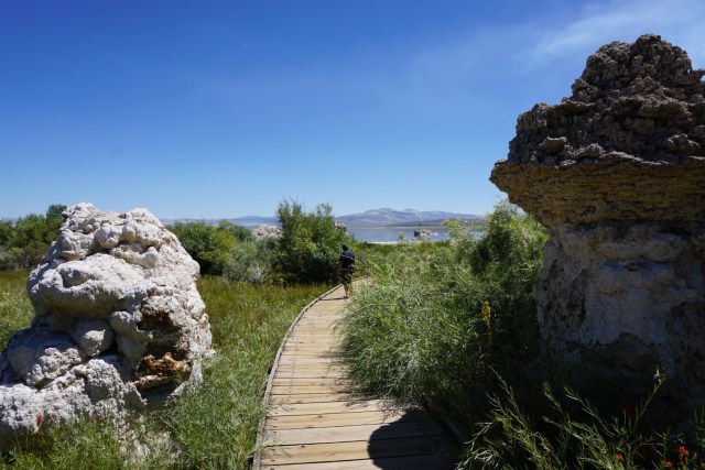
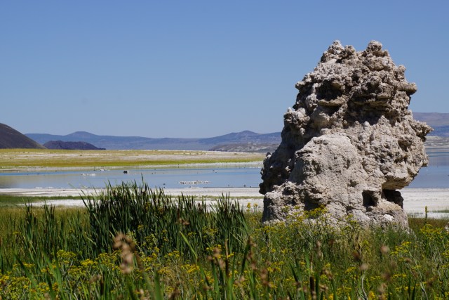
In eastern California Mono Lake has suffered from years of water extraction for irrigation. In 1994 it was agreed that extraction would be reduced to allow the lake to return to 1961 levels but it is now a long way below even the 1994 level. The photo shows Eddie heading down to the lake somewhere near the 1994 level. The remarkable tufa towers used to be in the lake.

image

image

Mono Lake

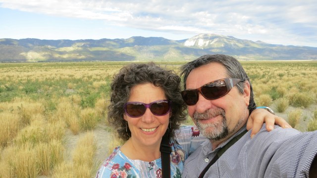
Lake Washoe (east of Lake Tahoe) is a startling illustration of how dry things are. The lake is 6.5 kms long and more than 3 kms wide and is normally about 3.5 metres deep. At the moment it is a meadow and the photo below shows Eddie & I on the ‘lakeshore’. The lake also disappeared in 1990s and early 2000s.  Washoe Lake is an important stop for migratory birds and also has a population of shellfish and I imagine fish and other animals. I wonder how long it takes them to come back, especially the shellfish who can’t move here very easily. The lake drying up is not a new thing though, as evidenced by sand-dunes made over thousands of years during dry periods.

image

Washoe Lake

After Washoe Lake we’d planned to stay at Lake Lahotan, a reservoir further east but it is now a large brown puddle and not an attractive proposition at all. The next day (after overnighting in our first RV park) we stopped at Grimes Point Archeological Area, one of the largest petroglyph (rock art) sites in the US with the art work in the photo below believed to be about 6,000 years old. Until about 10,000 years ago much of Nevada was covered by vast lakes and Lake Lahotan once reached this far (about 35 kms away from the brown puddle) and Grimes Point was a rocky peninsula. The old lake levels can be seen below the two pointed hills in the distance. Today Grimes Point is in the middle of a dry area near Fallon and while we were there we were deafenened by fighter jets taking off from the airbase nearby.

image

Eddie at Grimes Point with rock-art

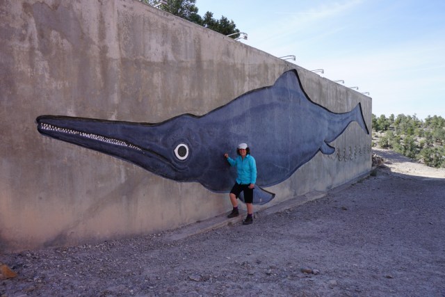
We travelled through Nevada’s dry back-country to reach Berlin-Ichthyosaur State Park. The attraction here was the chance to see fossils of this strange dolphin like creature, a reptile that roamed the seas at the time of dinosaurs. Ichthyosaur fossils are found all over the world but the specimans found at this site are the largest – about 15 metres long. The site of the remains have been preserved in a ‘fossil house’ which Eddie and I had a tour of for the princely sum of $3 each. Thanks Ranger Mike.

image

An artist's representation of a 15m long ichthyosaur

In the same state park is the ghost town of Berlin, established in 1896 to exploit silver. It lasted until 1911 by which time nearly five kilometres of tunnels had been built and $849,000 of silver extracted. I am not sure what that would equate to in today’s money. We’d been hoping to explore the Diana Mine but a flash-flood about three weeks before had filled the mine with silt. Sadly the flood had also flowed through some of the buildings and, as there didn’t appear to much money being spent in the park, it didn’t seem likely it would be removed.

image

One of the gullies that provided a shute for floodwaters

image

The Berlin Mill where the ore was processed

image

Mrs Steven's house at Berlin

Apart from the damage caused it’s hard to believe that there’s been  much rain. Most of Nevada consists of unestimatable acres of hardy sage brush. I like Nevada, it’s empty and stark and has fantastic and varied rock formations. But despite a lot of mining activity rural areas are suffering and we saw lots of abandoned buildings and many small towns seemed to be barely clinging on. And while I like the balmy Nevada evenings, it’s been really hot (37 at Fallon) so I’m looking forward to cooler temperatures on the higher plateaus in Utah and Arizona.

Posted in Uncategorized | 3 Comments

A week in the Sierra Nevadas

image

Secret Lake, near Leavitt Meadows, east of Sonora Pass.

After a great experience picking up our ‘Minnie Winnie’ from Apollo RV at San Leandro (near San Francisco), and despite horrendous head-colds, Eddie and I bravely set out for the mountains. First we had to stock up with supplies so by the time we left the outskirts it was late but Eddie did a fantastic job driving to the maximum speed limits all the way so that we got to Calaveras Big Trees State Park campground by dusk.

Calaveras Big Trees State Park is in the foothills of the Sierra Nevadas and preserves two magnificent groves of giant sequoia – the world’s largest trees (in volume). They are native to the western slopes of the Sierra Nevadas and can live for up to 3000 years. The trees are truly impressive – the one in the photo below had a diameter of about 30ft. We’d struck a heat-wave in San Franciso (30 degrees instead of the 17 degrees it was last time we were there in August) and it was no cooler at Big Trees, in fact it was 31 degrees in the shade at 4.15pm. One the walk around the North Grove we saw a woman running (!) back to the visitor centre to get help for her mother and aunt who were 80 & 85 and couldn’t walk any further. A woman in another group commented to us that as there wasn’t mobile phone coverage ‘they’ should really have panic buttons along the trail which is a 1.5 hour basically flat walk.

image

A giant sequoia, Calaveras Big Trees State Park.

From Big Trees, despite warnings about narrow roads & tight bends, we headed along  state highway 4 up and over Ebbetts Pass which was a great drive through glacier sculpted granite country and volanic rock. It is not for vehicles over 25ft long though – we are 22ft long and quite tall and wide.

We were planning to visit the eastern side of Yosemite  National Park but the campground had been evacuated as a precaution against the plague. Two dead animals had been found with the plague and the danger was that fleas from the animals could infect humans. Thank goodness that we don’t have to worry about the plague in NZ – there are signs about it in all the campgrounds here. A major pesticide spraying operation was being undertaken at Tuolumne Meadows (where there is a 300 site National Park campground) and Mono Lake (more on that later) was awash with displaced RVers. It was very hot and we knew that we’d never find a campsite with shade so we decided to back-track and head back into the mountains, this time on state highway 108 over Sonora Pass.

This was our highest pass so far at 9628ft (2934m) and the big Ford engine handled it beautifully. It’s a long drive and the road must have been incredibly hard to build. The altitude was noticeable to us and it would be under snow for months while in the summer it’s very hot. After the discovery of Comstock Lode (silver & gold) in Nevada there was a rush east from California. Sonora Pass was opened as a pack track in 1862 and was a road by 1865 – an amazing achievement.

We stayed three nights at Dardanelle to try and let our colds run their course and then retraced our steps, this time stopping at the pass for a short walk along the Pacific Crest Trail which crosses the road at this point. Up here the landscape is volcanic as these rocks stood higher than the eroding glaciers that created the bare granite landscape at lower elevations.

image

The vista from near Sonora Pass, note the volcanic rock

image

Walker River below Sonora Pass, back in granite country

We finished our Sierra Nevada experience with our first hike, leaving Leavitt Meadows at 7.00am to beat the heat. Our destination was Secret Lake (photo at top). We heard a siren as we were returning to the campground and later heard that there is usually an accident a day on the Sonora Pass road and that a team of paramedics is kept on standby at the nearby Marine Mountain Training Base.

Nearly everyone here is mad on fishing with the popularity of a campground pretty much solely based on its proxmity to water. We’ve seen people fishing surprisingly small streams and wondered why they bothered. The mystery was explained on our last morning in the Sierra Nevadas when what looked like a water-tank truck came through the campground. Our neighbour Ray explained that it was delivering fish for the river. We thought they’d be juveniles but no, they are big fish, really big fish! Eddie and I disagree on the exact size (of course) but they were probably about 500mm long. Eddie wished Ray good luck with the fishing but Ray said that it wasn’t fishing, he’d be ‘just hauling them in.’ We saw the truck again further down the road and they were scooping out net loads of really big fish out of the tank and dropping them off the bridge into what I would call a creek. I wonder how long they survive if they are not caught?

From here we are heading into Nevada which is in the grip of a serious drought, in fact I don’t think it has rained there since we last visited three years ago.

Posted in Uncategorized | 3 Comments

Exploring southwest USA

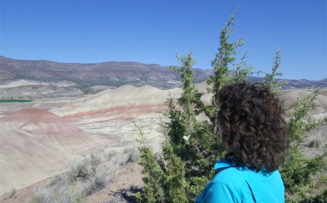
Painted Hills, Oregon

Painted Hills, Oregon

After having such a fabulous time in 2012, we’re about to do it again – only this time for longer.

Eddie & I were enraptured by the grandeur of the scenery and the fascinating geology on our last visit and on the itinerary this time is Nevada (again – we really like it and this time we’ll do the alien highway), a thorough exploration of southern Utah, a few more places in southwest Colorado, Arizona (including both rims of Grand Canyon), maybe New Mexico (if time allows) and then we’ll loop back to San Francisco through southern California including the Mohave Desert and Death Valley.

IMG_1386

Mesa Verde National Park, Colorado

We learned such a lot on our last visit including an appreciation of the vastness of the USA and the complexity of it. We were impressed by the quality of the camping grounds in national and state parks, how polite people were, the excellent visitor centres, the ancientness of the landscape and were especially moved by the very old native American sites and stories of their more recent hardships.

Surprises were the fact that the US has problems with introduced pests (including NZ mudsnails) and the impunity with which native animals are killed. We saw many celebratory photographs in gas stations and the like of people posing with cougars, bears and other animals that they had killed. In NZ our native animals are so vulnerable and we spend a lot of time and money looking after them (mostly) so killing native animals for sport seemed odd to us. I am cheered to see that California has just out-lawed trapping bobcats for fur.

After collecting an RV (no station-wagon for us this time) we’ll be heading across the Sierra Nevada mountains on our way to Nevada. I’ll be posting about the interesting things that we discover – I’d love you to join us.

Banner image

Left to right; Black Canyon of Gunnison NP, Yellowstone NP, Canyonlands NP, Eddie attacking a bear.

Posted in Uncategorized | 3 Comments

Travelling America’s Pacific Rim of Fire

Nearing McKenzie Pass, Cascade Mountains, Oregon

After our sojourn in the desert and prairies of eastern Oregon we drove west to the Cascade Mountains. These are part of the ring of volanoes and mountains that make up the ‘Pacific Rim of Fire’.  As usual we skipped the towns and headed to the forest but we had some difficulty finding a decent camping spot, eventually finding one at the fourth campground we tried which was the last on the road that runs alongside the Metolius River near the tourist town of Sisters. The campgrounds were busy and many sites were reserved, obviously in preparation for the upcoming Labour Weekend when literally everybody seems to have their last summer holiday. We started out early the next morning so we could drive the Santiam/Mckenzie Pass loop and still get to a campground before it was too late in the day and we missed out. We squeezed in a fantastic walk through forest (a bit of a novelty on this trip) to waterfalls on the McKenzie River which were tumbling over basalt ledges.

Mckenzie River near Koosah Falls, Oregon.

We should have stopped at the Lava Lands Visitor Centre but we were worried about a campsite so we drove straight on to Newberry National Monument, which is the largest caldera in the Cascades volanic arc. Inside it are two lakes (Paulina and East) which were probably orginally one but were divided by deposits of pumice and lava. The oldest lava flows here are 400,000 years old but the youngest was formed only 1,300 years ago. We get a campsite by driving to the farthest campground (there are four).On the way in we stop at the Visitor Centre and Ranger Terra (who is a real treasure) shows Eddie how to fold the American flag, it must be folded in a particular way so that when it is done 13 stars (representing the first 13 states) are showing. We comment on the fact that we see the American flag everywhere and Terra tells us that most Americans treat the flag like a person (obviously a very well respected person).

Eddie & Ranger Terra folding the U.S. flag, Newberry National Monument.

Next day we walk the Lake Paulina circuit (7.5 miles) and then head on to ‘Big Obsidian Flow’ (which is the bit that appeared 1,300 years ago) where we have a good view of Lake Paulina after we’ve tired of marvelling at the glass-like and amazingly jagged flow. Native Americans travelled here to collect obsidian to make knives and tools and apparently an archaeologist was so impressed with how sharp and smooth obsidian edges were that he had scalpels made and instructed a surgeon to use them on him with exceptional results.

Lake Paulina, Newberry National Monument.

Big Obsidian Flow.

From Newberry we headed towards our next geological feature Crater Lake but first we stopped in La Pine for breakfast at Gordy’s Diner (a truckstop) where Eddie had the best steak of the trip.

Queuing to get into Crater Lake National Park, I think we had to wait 20-30 minutes to get to the head of the line.

After queuing to get into Crater Lake National Park the actual road through the park wasn’t too busy but the crowds at each overlook were pretty big and when we got to Rim Village it was all rather overwhelming. Well, we had to be somewhere for Labour Weekend but this certainly wasn’t the best place. Crater Lake is extraordinarily beautiful (I can see why it is so popular) but the crowds were not. All the accommodation options were full so we high-tailed it out of there. We’ll return someday to do some of the hikes, but not on a holiday weekend!

Crater Lake – the result of a massive eruption 7,700 years ago which left a basin where a peak used to be. Rain and snow filled the basin and the water is exceptionally clear.

As we drove south place after place had no vacancy signs out but we lucked into a cottage near Klamath Lake which had a huge bathroom and (oh joy) an oven – Eddie was missing his roast potatoes. We had lovely views of the mountains across the lake and could hear coyotes singing in the distance although we didn’t see any.

The view from the cottage in evening light – nice

Suitably restored by showers, foot-scrubs, roasted potatoes and sleeping in a decent-sized bed we carried on south through the Tule Lake National Wildlife Refuge, which was very dry although when there was water there were thousands of birds, to Lava Beds National Monument in Northern California. You might think that would have had enough lava by now but we were finding it all fascinating and loved the wide vistas that these sparsely vegetated areas gave us. Lava Beds are part of the Medicine Lake Volcano which over a million years has created endless miles of volcanic stuff. The last eruption was 1,100 years ago but it is now considered dormant.

Lava Beds National Monument from Fleener Chimneys

I was especially keen to see Captain Jack’s Stronghold, an area of lava flow where Kientpoos (Captain Jack) and 150 of his Modoc people held off the U.S. Army for five months. The story goes like this (it may sound familiar). Settlers wanted to take up land around Lake Tule and in 1864 the Modoc were asked to give up their homeland and live on a reservation near Klamath Lake. On the reservation tensions between the Modoc and the other tribes sent there and the shortage of supplies promised by the U.S. government led to the Modoc returning to their lands. The Army was ordered to return them to the reservation – by force if necessary – and a skirmish at Lost River resulted. Many Modoc fled to their traditional stronghold by Lake Tule, successfully rebutting the U.S. Army for five months until their water supply was cut off. They left in the dead of night and broke up into small groups but were later captured. Kientpoos and three other warriors were hanged and the rest of the men, women and children were sent to a reservation (at one point chained together in cattle cars) in Oklahoma, half a continent away.

Eddie on the trail through Captain Jack’s Stronghold

I know this now, but the interpretation at the site was coy about the eventual fate of the resistant Modocs. Neither the hangings or the exile were mentioned. This wasn’t the first time that we’d noticed this kind of reticence. Many information panels started with details of the original inhabitants and how they lived but then jumped to the life of the later white settlers without mentioning how the settlers acquired the land or the fate of the native Americans whose home it was. I got cross about this a few times but at this site in particular.

Aside from being the scene of the Modoc’s resistance Lava Beds is also well known for its enormous number and variety of lava tubes. We explored a few, some of whose entrances were adorned by pictographs painted by the previous inhabitants who used the caves for special cultural ceremonies. Some of the caves were very rough, some had ice at the bottom (!) but our favourite was Valentine Cave (found on that day) which was wonderfully smooth.

Just inside the entrance of Valentine Cave, Lava Beds National Monument.

After Lava Beds we headed south along the Volcanic Legacy Scenic Byway. The road was an interesting succession of gravel washboard, seal with enormous gouges in it (snow plough?), wide asphalt, single lane but sealed and finally a two lane sealed road of average quality. By looking at the map we could see that the road quality depended on who was responsible for it and presumably how much budget they had left that year.

Our best lunch spot – Lake Helen with Lassen Peak in the background

Our next ring of fire stop was Lassen Volanic National Park which erupted energetically between 1914 and 1921. The park had only recently re-opened after being evacuated due to forest fires and we drove through some of the damage (no stopping allowed). The trail up Lassen Peak was closed for trackwork to make it safer after a boy was killed by a rock-wall collapse in 2009 so we’ll have to do it next time. Instead we hiked into Bumpass Hell, (named after an early guide, Kendall Bumpass, who fell into a pool and burned his leg), an amazing thermal area with the hottest steam vent in the world that’s not actually in an erupting volcano (161 degrees C). There are lots of things named hell or devil in volcanic areas.

Bumpass Hell, Lassen Volcanic National Park

We’d love to have spent more time at Lassen, there’s lots to explore, but we needed to start making tracks back to San Francisco and our flight home. We spent a couple of very hot days on the gold-fields where I lamented the fact that there is so little to see on the ground and that everything was closed (most things were only open Thursday to Sunday even during the summer). Plumas-Eureka State Park was excellent (hard rock mining but also the birth-place of skiing in North America).

Rock Lake, Eureka State Forest.

We also went to the site of Marshall’s 1849 discovery of gold in a sawmill tail-race which started the whole California gold-rush. Great museum but most of the buildings were closed and the actual discovery site was a little underwhelming.

The site of the first discovery of gold (by Europeans) in California – 1849.

We stayed in a brilliant little cottage to relax and pack (which took a while) and then drove to San Francisco to begin our journey home after a fantastic trip – reflections will be next up.
Posted in Uncategorized | Tagged , , , , , | Leave a comment